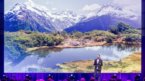
The natural Australian landscape faces ongoing threats, with the number of plant and animal species listed as threatened increasing by almost 10% between 2016 and 2021.
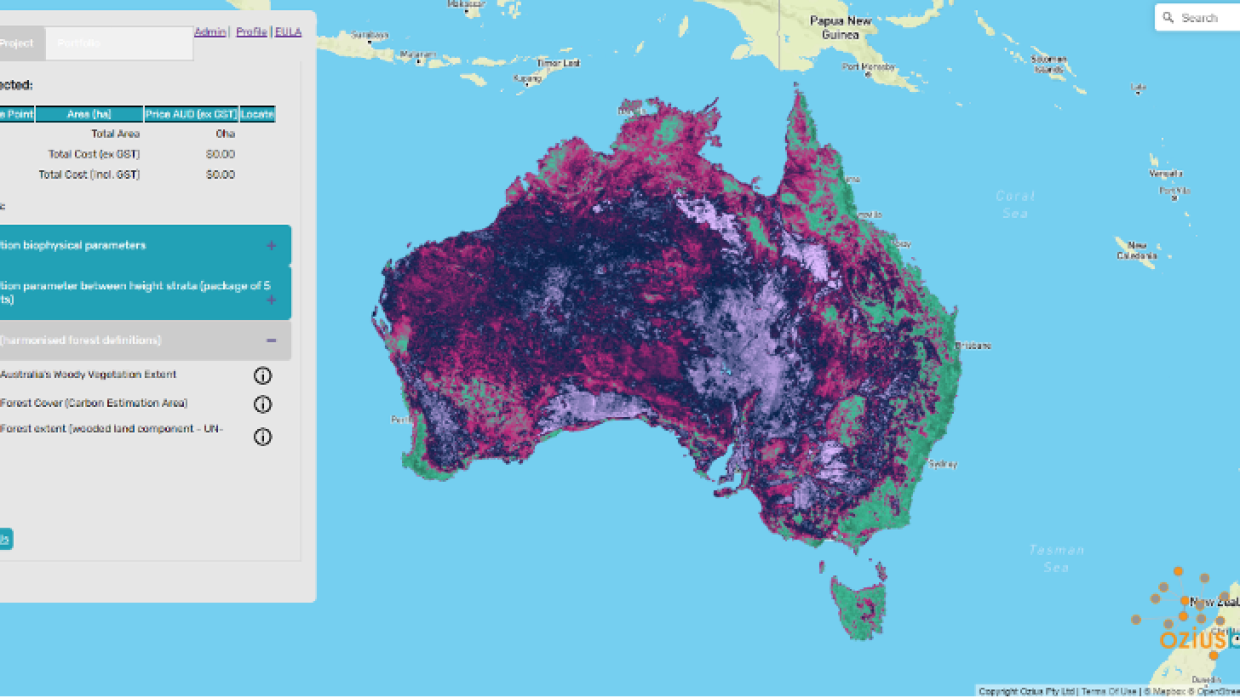
Brisbane-based environmental intelligence company, Ozius, is using earth observation technology together with spatial information, and environmental science, to help organisations make sense of environmental data. The insights help to inform decisions and shape their response to deliver positive outcomes. Earlier this month, the company officially launched Ozius Biome®, a proprietary platform that synthesises data captured from satellites and light-detection-and-ranging (LiDAR) technologies, combined with artificial intelligence, to generate data on Australia’s vegetation.
When this data is combined, it allows organisations across a range of sectors, including government, energy, and defence to identify opportunities from carbon-trading, monitoring deforestation, and environmental restoration, to prepare for bushfires or floods and detect landscape changes. Biome offers its customers unprecedented access to environmental intelligence, from canopy cover to generating 3D vegetation structures. This enables customers to thoroughly investigate landscapes, make confident recommendations and help unlock more sustainable opportunities.
Providing cost-effective and high-performance access to environmental information
As governments and organisations push forward with ambitious climate goals and net zero initiatives, greater advances in technology and stronger cross-sector collaboration are needed to meet these goals. Understanding the demand for such intelligence technology, Ozius sought a scalable, high-performance IT system to deliver advanced environmental analytics to its customers.
Against a backdrop of the urgency required for conservation efforts, the ability to process insights in real-time drove Ozius to search for a faster, more robust solution, and it soon landed on Amazon Web Services (AWS).
Data to insights – from months to hours
Prior to AWS, Ozius was running an on-premises database system, which would have taken up to five months to process over 170 million environmental data points and 24 months of satellite imagery data across continental Australia. By deploying Amazon Aurora to deliver database performance and availability at scale, alongside its open-source spatial databases, Ozius can ingest up to 10 times more data and process highly complex spatial data points 450 times faster than its previous system, enabling it to make informed decisions at speed. Simultaneously, using the latest serverless technology on AWS helps Ozius optimise compute costs and resources to drive greater cost efficiencies for its customers. Its Biome product is generated with a 10-fold cost efficiency, and it is passing these savings to customers.
“Traditional data analysis methods have been a processing and time constraint for our business and limited the market for both us and our customers, as it was difficult for some projects to commercially stack up,” said Alisa Starkey, Founder, Director, and Chief Science Officer at Ozius. “The environment around us is changing at lightspeed – anything less than a game-changing solution doesn’t cut it anymore. AWS helped reduce the collation and analysis process of geospatial data for our customers from six months to a matter of hours. This empowers our customers to make informed decisions with positive, lifelong impacts and allows our team to innovate and create new solutions, faster.”

Ozius has improved the resolution of its environmental-intelligence products and can now offer vegetation imagery products that are 100 times higher resolution what was previously available – going from 200-by-200 metre resolution to show close ups of vegetation within a 20-by-20 metre area. Supported by round-the-clock technical support from AWS, this has enabled Ozius to reconstruct Australia’s vegetation landscape with greater accuracy and fidelity. Without Biome, organisations would need to fly a plane and use airborne lidar or go into the field and measure it manually in order to collect a similar quality of data in localised areas. Ozius helps quantify the landscape remotely, without having to step on the habitats it’s aiming to protect.
Iterating models of its geospatial solutions used to take Ozius one-to-two years, and updating a single model also took a significant amount of time. With AWS, Ozius can go from concept to trial or deployment in days. It can provide solutions like near real-time feeds or updates to its clients after a natural event takes place, or even create a 3D environment to be able to extract more insightful information. This helps ensure Ozius’ products meet and adapt to the needs of its customers.
Collaborating for a sustainable future
Achieving net zero carbon emissions is only possible when like-minded organisations share the same vision and collaborate. Since Ozius Biome’s conception, it’s begun working with organisations across natural capital markets, government, energy, and defence sectors. This includes Market Advisory Group (MAG), advisors for Australia’s emerging carbon market and renewable energy sector, who are using Biome to collect more consistent and accurate data, and create more robust risk management strategies for their clients.
RedEye, an Australian asset data management solutions provider for critical infrastructure owners and operators, is using Biome to meet similar client needs.
“With conservation efforts today, a digital-first approach is needed. Biome enables us to identify degraded landscapes containing bushfire catalysts like thick undergrowth which can lead to intensified wildfires if left unmanaged. We assess risk and how a range of management practises, including cultural burning or traditional owners land management can reduce risk, cost and restore country,” said Andrew Sturgess, Technical Director, Fire Technology at RedEye. “We now have an incredible opportunity to achieve our goal of shaping a healthier environmental future for Australia.”
Market demand drives immediate results
“Since Ozius Biome launched in July 2022, the company has received strong interest from some of the largest public and private organisations in Australia, across sectors like oil and gas, utilities, and agriculture” said Starkey. In the first month since launch, the company saw a rapid uptake, with over 115 million hectares of Ozius Biome data sold.
“Our environmental intelligence is critical as governments set new environmental standards and policies, and communities and investors demand a shift towards decarbonisation. It’s a race against time to lower our carbon emissions and every second we can save can prove critical for our business and customers. By collaborating with AWS, Ozius is powering and pioneering a new technology that alleviates some of Australia’s most pressing challenges. The results Ozius has achieved so far have been encouraging and we’re optimistic about how much we can continue to push the boundaries and make a meaningful impact for our environment.”
Geospatial solutions shape the future of environmental protection
Geospatial companies like Ozius are reimagining how we tackle the most pressing environmental challenges facing our world. Whether it’s increasing pressure from climate change, loss of biodiversity or demand for natural resources from already stressed ecosystems, it’s essential to understand and address environmental changes by making sustainable land use decisions with the latest and most accurate data. AWS is committed to supporting organisations of all sizes, across all sectors to innovate, build and implement solutions, like Ozius Biome, to help meet sustainability goals. By leveraging technology in a meaningful way, organisations can drive growth while also supporting the environment, meeting joint goals that aid the future of the earth.


